Agros® Solutions
Whether you’re a banker, insurance broker, or sustainability executive, we help you put location intelligence to work for your business. Our team transforms complex and highly valuable asset-level geospatial data and imaging into easily accessible locational intelligence tools that help you assess growth opportunities, find operational efficiencies and ensure your daily financial and business decisions are more predictive and precise.
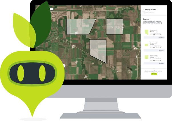
Agros® Technology
Agrograph’s Agros® Technology combines satellite imagery, diverse data sources and field-scale, predictive modeling to report on validated metrics such as land management practices, retrospective and predictive yield production and weather patterns, environmental impact, soil carbon metrics, market value, and more. Through our sophisticated data acquisition, aggregation and analysis methods and platform, you can easily access and customize this intelligence to evaluate new opportunities and make more predictive decisions.
Trusted By


The Future of Agriculture is Here
Gain free access to our platform. No credit card required.